
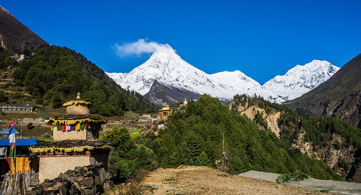
The Manaslu Circuit Trek follows the valley of the Budhi Gandaki River to Mount Manaslu (8,163 m), the eighth-highest mountain in the world, over Larkya La Pass, which stands at an elevation of approximately 5,106 m. The trek generally takes about 13 to 14 days to complete, though there are some trekking schedules that take longer. There are differing accounts of distance for this trek in the literature, and many treks have a reported distance of about 157 to 180 km. The route climbs slowly from the valley of the river at the bottom to the mountain pass at the top and then descends toward the Annapurna Circuit.
However, Manaslu Circuit Trek maps do not always provide the same starting points, walking distances, and village elevations. In some cases, treks may start from Soti Khola, whereas in other cases they start from Machha Khola and end up around Tilije or Tilje and Dharapani. Such knowledge is useful for trekkers in order to understand walking hours, prepare for altitude changes, and identify the most demanding sections.
This guide will give an overview of the Manaslu Circuit Trek Route Map, altitude of the villages, distance of each day’s walk, gain/loss of elevation, Larkya La Pass crossing and how to use a trekking map.
Manaslu Circuit Trek route map
The Manaslu Circuit trek takes you along the Budhi Gandaki River in northern Gorkha, over the Larkya La Pass to the Annapurna region. It begins from Machha Khola and goes via Jagat, Deng, Namrung, Lho, Shyala, Samagaon, Samdo, and Dharamsala before it crosses the Larkya La Pass. Once it crosses the Larkya La Pass, it goes down to Bimthang, Goa, and Tilije. Manaslu Circuit Trek takes you through forests, farms, valleys, villages, and into the mountains above 4,000 m.
Main Manaslu Circuit trekking route:
Machha Khola → Jagat → Deng → Namrung → Lho → Shyala → Samagaon → Samdo → Dharamsala → Larkya La Pass → Bimthang → Goa → Tilije → Dharapani

The trail goes north through the Budhi Gandaki Valley, then westward through the Larkya La Pass into the Dudh Khola Valley, and finally joins the Annapurna Circuit Trail at Dharapani.
Where does the Manaslu Circuit Trek start and end?
Manaslu Circuit Trek begins from Machha Khola, which lies between 870 and 890 meters, and ends somewhere around Tilije or Dharapani, as per the route chosen. Soti Khola has been the preferred starting point of this trek in the past. However, road construction has made it possible for vehicles to drive up to Machha Khola, if proper conditions are present. The trek starts from Kathmandu and goes towards Arughat by road and then reaches the starting point. Himalaya Heart’s 14-day itinerary finishes walking at Tilije, approximately 2,300 m, before returning to Kathmandu.
Major villages along the Manaslu Circuit route
The main villages in the Manaslu Circuit Trek route have facilities like accommodation, food, and resting points between each stage of trekking. Machha Khola, Jagat, and Deng are situated on the banks of Budhi Gandaki River, and trekking follows river routes, overhanging suspension bridges, through forests and fields. After Namrung, in Lho and Shyala, trekkers can find stone house architecture, Buddhist monasteries, prayer flags, and Himalayan mountains. Samagaon village is very important for acclimatization purposes, and Samdo village is considered to be one of the last settlements before a high pass.
In Dharamsala, trekkers can find accommodation facilities before crossing Larkya La Pass, and then trekking continues in the valley of Bimthang toward Goa/Gho and Tilije.
Manaslu Circuit trail conditions and route changes in 2026
The Manaslu Circuit has been affected due to the damage caused by flooding in the Budhi Gandaki valley area on October 11, 2026. The trails, bridges, access roads, and lodges have been affected. After October 25, trekking has resumed in the area, and a few repairs have been done. Now, it is possible for vehicles to reach Machha Khola. A temporary trail has also been built in Yaru Bagar, which bypasses the flooded trail. The newly built bridges and trails may not be shown in old maps used for trekking circuits. Individuals planning the trail must check the status of trails and bridges before the start of their trek.
Manaslu Circuit Trek at a glance
The Manaslu Circuit covers a wide range of elevations, from the lower Budhi Gandaki valley to Larkya La Pass above 5,000 m. The following table provides the main route information needed to understand its location, duration, distance, and highest point.
| Particulars | Details |
|---|---|
| Trekking region | Manaslu, Gorkha, Nepal |
| Main mountain | Mount Manaslu (8,163 m) |
| Trip duration | Around 13 to 14 days, depending on itinerary |
| Distance | Approximately 157 to 180 km for longer route variations |
| Starting point | Machha Khola (870 to 890 m) |
| Trekking endpoint | Tilije or Dharapani |
| Highest point | Larkya La Pass (approx. 5,106 m) |
| Main river valley | Budhi Gandaki |
| Main acclimatization stop | Samagaon (approx. 3,530 m) |
| Main high pass | Larkya La Pass |
| Route type | Circuit-style mountain traverse with road transfers |
The actual walking distance may be shorter than the commonly quoted totals when the trek begins at Machha Khola and ends at Tilije. Optional hikes and additional walking stages can increase the overall distance.
Manaslu Circuit Trek distance and elevation by day
The Manaslu Circuit Trek distance and elevation change depend on each walk segment. For the lower segments, the journey is quite long through valley trails, forested areas, suspension bridges, and stone steps. While trekking towards Samagaon and Samdo, the distance gets shorter because of high altitudes. The toughest walk segment on the route is considered to be the one from Dharamsala to Bimthang via Larkya La Pass. Comparing the daily distance, overnight elevation, and walking hours helps trekkers understand what each stage involves.
| Trekking stage | Approx. distance | Starting elevation | Ending elevation | Net elevation change | Walking time |
|---|---|---|---|---|---|
| Machha Khola to Jagat | 14 to 22 km | 870 m | 1,340 m | +470 m | 6 to 8 hours |
| Jagat to Deng | 15 to 20 km | 1,340 m | 1,860 m | +520 m | 6 to 8 hours |
| Deng to Namrung | 14 to 19 km | 1,860 m | 2,630 m | +770 m | 6 to 8 hours |
| Namrung to Samagaon | 17 to 20 km | 2,630 m | 3,530 m | +900 m | 6 to 7 hours |
| Samagaon to Samdo | 7 to 9 km | 3,530 m | 3,875 m | +345 m | 3 to 5 hours |
| Samdo to Dharamsala | 6 to 9 km | 3,875 m | 4,460 m | +585 m | 3 to 5 hours |
| Dharamsala to Bimthang via Larkya La | 18 to 24 km | 4,460 m | 3,720 m | -740 m | 8 to 11 hours |
| Bimthang to Goa | 12 to 18 km | 3,720 m | 2,515 m | -1,205 m | 5 to 7 hours |
| Goa/Gho to Tilije | 5 to 8 km | 2,515 m | 2,300 m | -215 m | 2 to 3 hours |
These are general planning estimates from route descriptions, not distances calculated based on one GPS track. Ultimately, the distance will depend on the chosen route, and the total net gain will not take into account all the ascents and descents made.
What is the total distance of the Manaslu Circuit Trek?
The total walking distance of the Manaslu Circuit Trek depends on the route’s starting point, endpoint, and optional excursions. Many published trekking guides report approximately 157 to 180 km for their versions of the circuit, but the walking distance from Machha Khola to Tilije can be shorter. Old trails starting from Soti Khola involve more walking down the valley of Budhi Gandaki. Trails heading for Dharapani cover more distance than the trails that end at Tilije. There are trekkers who also trek to the Base Camp of Manaslu, Birendra Lake, and many others. The real distance would be measured along the trail itself, and not along the combined distances of different itineraries.
Which section of the Manaslu Circuit Trek takes the longest?
The trek from Dharamsala to Bimthang via the Larkya La Pass is one of the longest and hardest sections of the Manaslu Circuit Trek route. It takes about 8 to 11 hours, depending on weather conditions and hiking speed. This trail ascends from Dharamsala, which lies at an elevation of 4,460 m, to Larkya La Pass, which lies at an elevation of about 5,106 m. Trekkers generally start their walk before dawn to give them enough time to cross the pass. Even though there are other parts of the trail that require much hiking, such as Machha Khola to Jagat and Jagat to Deng, they do not compare to the hard work involved in Larkya La Pass.
Manaslu Circuit Trek elevation profile
The Manaslu Circuit elevation profile shows how the trek rises from the low-altitude Budhi Gandaki valley to Larkya La Pass and then descends down towards the Annapurna region. The trek starts around 870 m at Machha Khola, and its elevation rises from Jagat, through Deng, Namrung, Samagaon, and Samdo. Trekkers climb above 3,500 m from Samagaon and Samdo. The trek rises from Dharamsala up to the highest point of the Manaslu Circuit, which is the Larkya La Pass at an elevation of 5,106 m.
The graph shows a steady overall climb toward Larkya La Pass, followed by a major descent to Bimthang. The actual line will also include smaller climbs and descents between villages.
How does elevation change along the Manaslu Circuit Trek?
The elevation increases gradually in the early days of hiking, from Macha Khola to Jagat and to Deng. The lower trail is the trail that follows the Budhi Gandaki River and has many ups and downs in the narrow valleys and over the suspension bridges. Another increase is seen from Deng to Namrung, which is roughly at 2,630 m. From Namrung to Samagaon, the trail climbs to about 3,530 m. After Samagaon, there are the trails to Samdo (3,875 m) and Dharamsala (4,460 m) and the pass of Larkya La. After the high point, the descent starts fast to the village of Bimthang and further lower villages.
Manaslu Circuit Trek village elevations
The villages along the Manaslu Circuit sit at different heights, which affects both walking effort and acclimatization. Lower villages such as Jagat and Deng are surrounded by river valleys and forests, while Samagaon and Samdo lie in a higher mountain landscape. Dharamsala is the final common overnight stop before the pass, while Bimthang is reached after the major descent. The table below shows approximate elevations in metres and feet for the main villages and important route points.
| Location | Elevation (m) | Elevation (ft, approx.) |
|---|---|---|
| Machha Khola | 870 | 2,854 |
| Jagat | 1,340 | 4,396 |
| Deng | 1,860 | 6,102 |
| Namrung | 2,630 | 8,629 |
| Lho | 3,180 | 10,433 |
| Shyala | 3,500 | 11,483 |
| Samagaon | 3,530 | 11,581 |
| Samdo | 3,875 | 12,713 |
| Dharamsala | 4,460 | 14,633 |
| Larkya La Pass | 5,106 | 16,752 |
| Bimthang | 3,590 to 3,720 | 11,778 to 12,205 |
| Goa | 2,515 | 8,251 |
| Tilije | 2,300 | 7,546 |
| Dharapani | 1,860 | 6,102 |
These elevations are approximate, and some sources use different figures for the same locations. They are useful for understanding how overnight altitude changes throughout the trek.
Manaslu Circuit Trek elevation gain and loss
Manaslu Circuit starts from Machha Khola, which is 870 m above sea level, and ends at Larkya La Pass at 5,106 m above sea level. In this way, the elevation difference would be 4,236 m. But the actual elevation gain in Manaslu Circuit Trek would be greater due to its undulating nature.
Which sections have the greatest elevation gain?
The largest elevation gains on the Manaslu Circuit trekking path are from Deng to Namrung, Namrung to Samagaon, and Dharamsala to Larkya La Pass. The trekking path makes an estimated gain of 770 meters of elevation from Deng (1,860 meters) to Namrung (2,630 meters) and a gain of 900 meters from Namrung to Samagaon (3,530 meters). An estimated climb of 646 meters is experienced from Dharamsala (4,460 meters) to Larkya La Pass (5,106 meters). Although shorter, this final ascent is more challenging due to the high altitude and rocky terrain.
How much elevation is lost after Larkya La Pass?
The trekking route descends from Larkya La Pass (5,106 meters) to Bimthang (3,590 to 3,720 meters), which will give a drop of about 1,386 to 1,516 meters. The long downward path might be demanding because of the steep and slippery terrain with rocky ground. From Bimthang, the trekking route moves down further towards Goa (2,515 meters) and Tilije (2,300 meters).
Larkya La Pass elevation and crossing route
The Larkya La Pass is the highest point and most difficult pass to cross on the Manaslu Circuit Trek. It is situated between Dharamsala and Bimthang and represents the only major crossing between the upper part of the Manaslu area and its western end. The altitude for Larkya La Pass is given at 5,106 m based on Himalaya Heart’s route description, though other trekking maps cite 5,160 m.
Route from Dharamsala to Larkya La Pass
The trek to the Larkya La Pass starts early in the morning from Dharamsala (4,460 m). The trek passes through rocky areas near the Larkya Glacier, with some parts made up of loose rocks, snow, and ice. The trek gains 646 m in elevation to reach the pass, which is located at an elevation of 5,106 m. The trek gets harder because of the high altitude, low temperature, and some parts of steep trails. On clear days, one can enjoy the view of the Himlung Himal, Cheo Himal, and Annapurna II. Walking time depends on the weather, trail conditions, and individual pace.
Descent from Larkya La Pass to Bimthang
Following the descent from the Larkya La Pass, the path heads downhill to Bimthang via stony slopes that might at times be covered in snow or ice. The descent is quite strenuous, and the trekker must be very sure-footed. The use of trekking poles and the right type of footwear will help balance the body and avoid undue pressure on the knees. As the journey nears completion, the rocky slopes give way to valleys.
Why is crossing Larkya La Pass challenging?
Passing through Larkya La Pass is difficult because of the high altitude, rough terrain, hours of walking, and changeable weather conditions. Beyond an altitude of 5,000 m, the reduced amount of oxygen will make walking strenuous, and snow, ice, and wind may also make the walk harder. Trekking to the pass normally begins very early to ensure that the trekker has enough time to trek back to Bimthang. Proper acclimatization, appropriate clothes, trekking shoes, and adequate water supply are required.
Acclimatization points along the Manaslu Circuit route
Acclimatization is an important part of trekking the Manaslu Circuit because the route reaches elevations above 5,000 m. As trekkers climb higher, the body needs time to adjust to the reduced amount of oxygen available in the air. Samagaon and Samdo are important stops before the higher sections near Dharamsala and Larkya La Pass. The elevation profile helps explain why some walking stages are shorter and why additional rest days may be needed.
Why is Samagaon an important acclimatization stop?
Samagaon (3,530 m) forms an important acclimatization halt before trekkers go higher up towards Samdo, Dharamsala, and Larkya La Pass. People normally add one more day of stay here to get adjusted to higher elevation. Walks through the village and up to Birendra Lake serve as an acclimatization activity, while trek to Manaslu Base Camp needs much more effort and time. The extra day in Samagaon is needed for the body to get adjusted to the lack of oxygen before going higher up.
How does the elevation change from Samdo to Dharamsala?
The route between Samdo (at 3,875 meters) and Dharamsala (at 4,460 meters) ascends an additional 585 meters. While the trekking distance may not be too long, the gain in sleeping altitude demands adequate acclimatization. Based on the guidelines provided by the CDC’s high-altitude travel guidance, a gain in sleeping altitude above 3,000 meters should never exceed 500 meters per day. If trekkers encounter any problems such as headaches, nausea, or dizziness, they should let their guide know.
Major landmarks and alternative routes on the Manaslu map
Manaslu Circuit Trek involves many significant natural as well as cultural sights, such as Budhi Gandaki River, villages in the mountains, Buddhist temples and high-altitude lakes. Lower parts of the trek follow the river valleys and bridge crossings, while in the upper areas travelers will be able to enjoy glaciers and Himalayan peaks around. Some of the sights are located directly on the route of the trek, while others may require further walking from the path.
| Route or destination | Starting point or junction | Main consideration |
|---|---|---|
| Birendra Lake | Samagaon | Shorter lake excursion |
| Manaslu Base Camp | Samagaon | Longer, higher-altitude hike |
| Pungyen Gompa | Samagaon area | Monastery and mountain views |
| Tsum Valley | Lokpa junction | Extended trek requiring more days and separate route planning |
These destinations are not all included in the standard Manaslu Circuit route. Adding them increases the walking distance and may require extra time for acclimatization or permits.
Birendra Lake and Manaslu Base Camp from Samagaon
Birendra Lake and Manaslu Base Camp are some of the popular side trips that can be taken from Samagaon. Birendra Lake is found close to the Manaslu Glacier at an altitude of about 3,600-3,700 m and can be done by hiking for a shorter period. Manaslu Base Camp, on the other hand, is located at an altitude of about 4,800 m and can be done by hiking for a much longer period. Both trails can be completed from Samagaon and done during the acclimatization day.
How does the Tsum Valley route connect with Manaslu Circuit?
The Tsum Valley trek diverges from the Manaslu circuit trail at Lokpa village. This trek then takes the hiker through villages like Chumling and Chhekampar. Longer trails then lead the hiker to Mu Gompa, where they can then rejoin the main Manaslu circuit trail. The inclusion of the Tsum Valley trek is an additional hike that takes more days, covers more kilometers, and requires restricted area permits.
How to read and use the Manaslu Circuit Trek map
The Manaslu Circuit Trek map is very useful when planning the trekking route by highlighting the main villages, walking distance, and altitude. Knowing how to read the map will make it much easier to locate the most critical stops, walking time, and hard trekking areas. The following steps describe how to use the map for route planning.
The following steps explain how to use the map for route planning:
- Find the starting and ending points. Check whether the route begins at Soti Khola or Machha Khola and finishes at Tilije or Dharapani.
- Identify the walking trail. Separate the trekking sections from roads used for transportation to avoid confusing driving distances with walking distances.
- Check village elevations. Compare the heights of overnight stops to understand how quickly the route gains altitude.
- Review daily distances. Look at the distance between villages and estimate walking hours based on the terrain and elevation changes.
- Locate Larkya La Pass. Identify the highest point and the major climb from Dharamsala, followed by the descent toward Bimthang.
- Check alternate trails: Find out which trails take you to Birendra Lake, Manaslu Base Camp, Pungyen Gompa, and Tsum Valley.
- Check status of trails: Inquire from your trekking guide whether there are any damaged bridges, landslides, or alternate trails that do not show up on your map.
Maps are useful for preparation, but they cannot show every recent trail change. Trekkers should use updated local information and follow their licensed guide during the journey.
Manaslu Circuit Trek map PDF and offline navigation
A Manaslu Circuit Trek map PDF is beneficial for trekkers to assess the route details, altitudes of villages, walking distances, and crossing of Larkya La Pass in advance as well as during the trek itself. Offline maps and GPS routes also play an important role in remote areas where mobile connectivity is not sufficient. Trekkers must download the maps of their routes from trustworthy websites because outdated routes can have dilapidated trails.
Permits and guide requirements for the Manaslu Circuit route
Foreign trekkers undertaking the Manaslu Circuit trek typically require three permits that include the Manaslu Restricted Area Permit, Manaslu Conservation Area Permit (MCAP), and Annapurna Conservation Area Permit (ACAP). Foreigners trekking the Manaslu Circuit have to carry these permits and show them at the checkpoints. According to new regulations introduced in March 2026 by Nepal, individual foreign trekkers can obtain restricted area permits from trekking agencies without another fellow trekker. However, a licensed guide remains mandatory, with a maximum of seven trekkers per guide.
Restricted Area Permits can be obtained through the Department of Immigration, while Conservation Area Permits are available from the National Trust for Nature Conservation. It is best if trekkers make sure of their exact requirements beforehand.
FAQs
How long is the Manaslu Circuit Trek route?
The Manaslu Circuit Trek covers a distance of roughly 157 to 180 km depending on the route followed, endpoint, and optional side trips.
What is the highest elevation on the Manaslu Circuit Trek?
Larkya La Pass is the highest point at approximately 5,106 m (16,752 ft), although some maps list it at 5,160 m.
Where does the Manaslu Circuit Trek start and end?
The trek commonly starts at Machha Khola and ends at Tilije or Dharapani. Some older routes begin at Soti Khola.
What is the average daily walking distance on the Manaslu Circuit Trek?
7 to 20 km is the distance covered by trekkers per day, with some stages covering more distance than others.
How much elevation gain is there on the Manaslu Circuit Trek?
The elevation difference from Machha Khola (870 m) to Larkya La Pass (5,106 m) is approximately 4,236 m. Total climbing is higher due to repeated ascents and descents.
How difficult is the Larkya La Pass crossing?
Larkya La Pass is challenging due to its altitude above 5,000 m, steep trails, cold temperatures, and long walking hours. Proper acclimatization and preparation are essential.
Can I download the Manaslu Circuit Trek route map as a PDF?
Yes, when the trekking company or map supplier provides a downloadable PDF map. Select the latest map, which indicates heights of villages, distances covered, and Larkya La Pass.
Conclusion
The Manaslu Circuit Trek follows a varied mountain route from the lower Budhi Gandaki valley to Larkya La Pass at approximately 5,106 m. It passes through villages such as Jagat, Namrung, Samagaon, and Samdo before reaching the highest point. After crossing the pass, the trail descends through Bimthang, Goa, and Tilije toward the Annapurna Circuit junction. The total distance depends on the starting point, endpoint, and optional excursions.
Understanding the Manaslu Circuit Trek route map and elevation profile helps trekkers prepare for walking distances, altitude changes, and the demands of Larkya La Pass. Checking the current route and planning enough time for acclimatization are important before starting the journey.
Explore Himalaya Heart Treks & Expedition’s 14-day Manaslu Circuit Trek package for the complete itinerary and guided trekking arrangements.